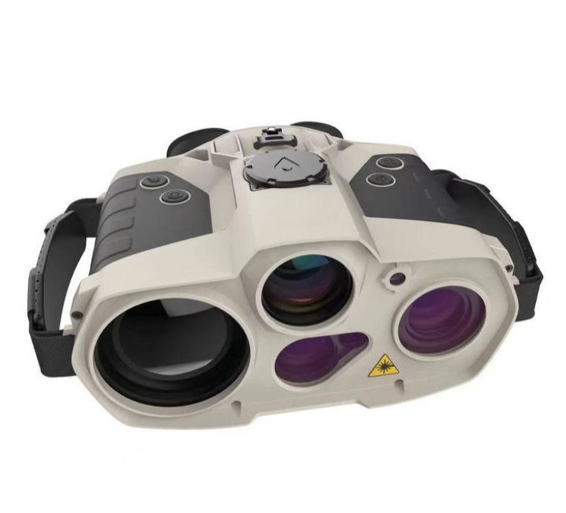
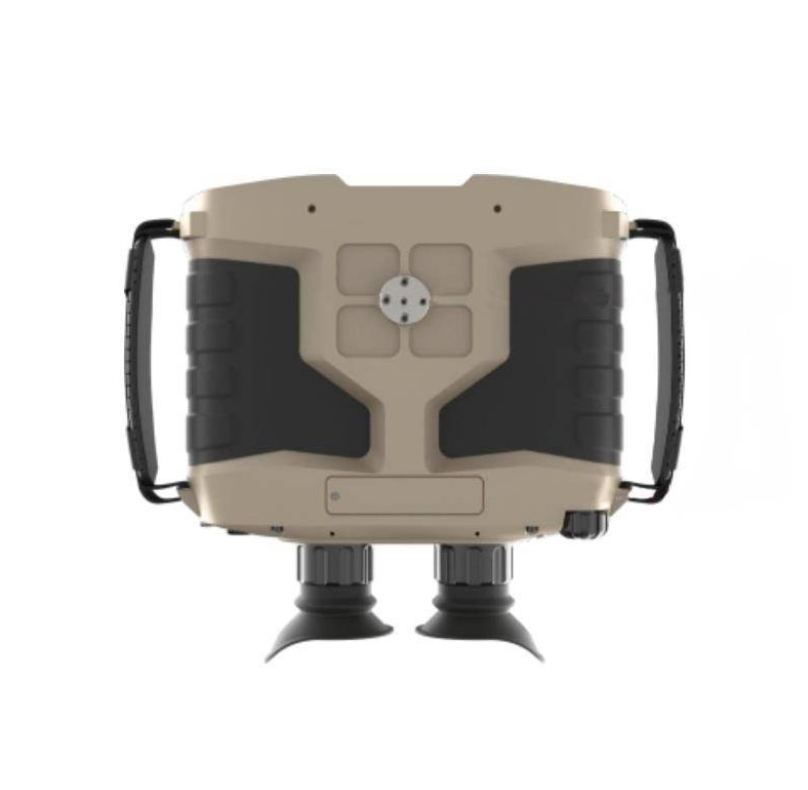
The binocular multifunctional handheld observation instrument is a handheld infrared detection device with multiple functions and uses that integrates infrared, micro-light, visible light and laser. It uses a system composed of multiple advanced sensors, processing circuits and optical components, which can observe and detect targets all day long in the daytime, night, haze, thick smoke and other environments. It supports built-in positioning module, electronic compass, laser ranging and image storage, fusion function, which can help users locate the observation position and geographic information such as target coordinates and orientation, so as to quickly discover and deal with the target. It is comfortable to use and easy to carry. It is suitable for scenes such as reconnaissance, surveillance, outdoor hunting and security protection.

1. The night vision device can record and take photos, with 5 optical channels, supports image fusion, infrared, low light, visible light, laser night market and other observation modes to meet the needs of different scenarios;
2. It integrates photo, video, storage and playback functions, supports self-positioning and target positioning functions, and can identify vehicle-shaped targets at a distance of 2km for infrared and 6km for visible light
3. The laser rangefinder has a working distance of 2~6000 meters, automatic calibration, and sensitive sensing;
4. It adopts a high-precision electronic compass, true north direction positioning, high reliability, strong anti-interference ability, and clear direction at a glance;
5. The night vision effect is clear, the recognition ability is strong, and the human features and license plate numbers of stationary vehicles can be recognized within 1500 meters at night;
6. It supports off-screen recording and optional 830nm red-free military-grade laser, which can effectively prevent the exposure of law enforcement personnel's own targets;
7. Built-in positioning module BD+GPS dual-mode positioning, light weight, long battery life, simple operation
8. With analog video and digital video output, it supports external power supply, USB, serial port and mobile device interconnection via WIFI, and can perform remote wireless observation and control

Product parameters:
Image zoom:
Electronic zoom: 1.0-4.0 times (infrared, low light, fusion change synchronously, single step adjustment step 0.1 times. Visible light image is electronically zoomed alone, zoom step 0.1 times)
Infrared thermal imaging performance
Resolution: 640×512, 12μm
Working band: 8~14μm
Field of view: 6.1°×4.8°
Low light imaging performance
Resolution: 750×600
Low illumination capability: 0.001lux
Field of view: 6.8°×5.5°
Visible light imaging performance
Resolution: 4.6 million pixels
Field of view: 4.6°×3.7°
Laser ranging performance
Wavelength: 1535nm
Maximum range: ≥6km
Minimum range: ≤50m
Range measurement accuracy: 2m
Positioning module performance
Positioning mode: Beidou navigation, GPS
Horizontal positioning accuracy (CEP): 5m
Elevation positioning accuracy (PE): 10m
Electronic compass performance
Magnetic azimuth measurement range: 0~360°
Magnetic azimuth measurement accuracy: 0.5°
Pitch angle measurement range: -90°~+90°
Pitch angle measurement accuracy: 0.4°
Tilt angle measurement range: -180°~+180°
Tilt angle measurement accuracy: 0.5°
Laser indication performance
Wavelength: 830nm
Safety level: 5mW, Class IIIA
Display performance
Resolution: 1280×1024
External interface
Aviation plug: DC/USB/PAL/RS232
Display: HDMI
Wireless transmission: WIFI
Complete machine performance
Storage: 64G
Eyepiece vision: -4~+4
Weight: 2.1kg
Working time: ≥8h
Dimensions: 198*210*105mm
Working temperature: -40℃~+55℃
Storage temperature: -55℃~+70℃
Waterproof level: IP67

